Afon Ceiriog
Source — Waterfalls — Swch-Cae-Rhiw — Pentre — Llanarmon — Tregeiriog — Hendre — Pandy — Glyn Ceiriog — Dolywern — Pontfadog — Castle Mill — Chirk
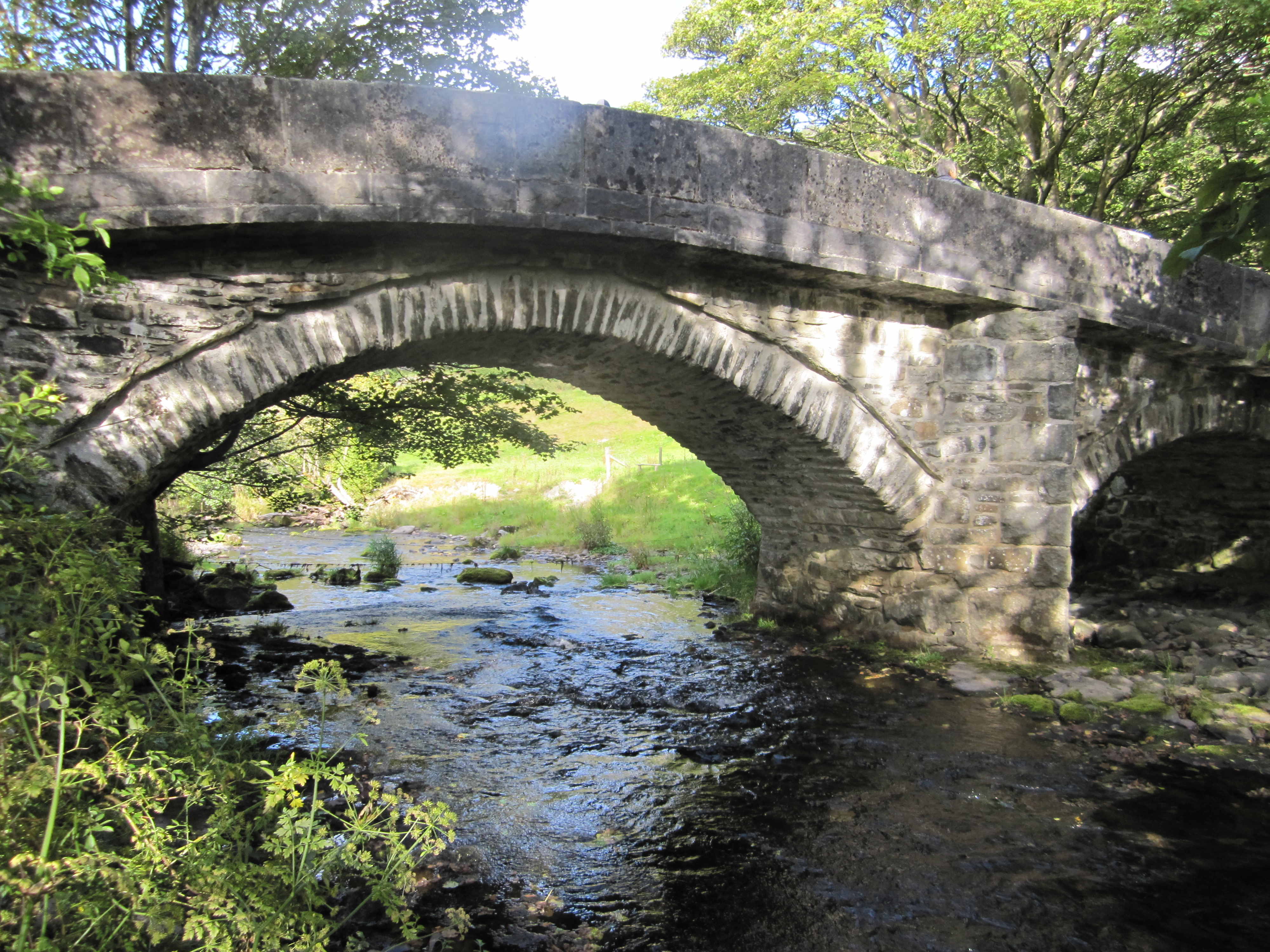
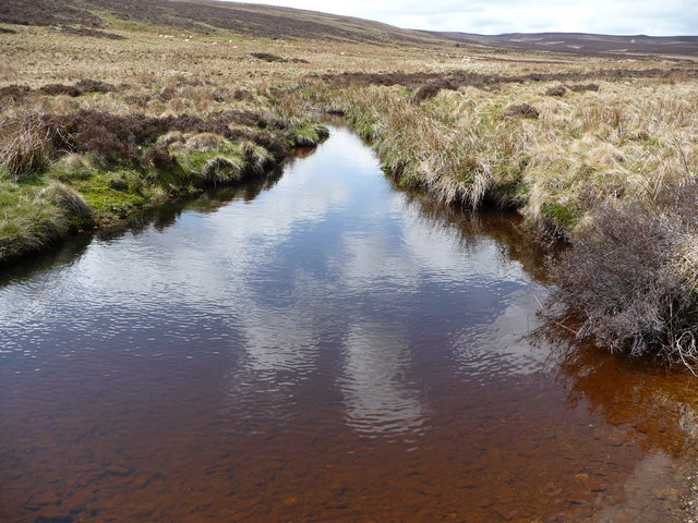 The Ceiriog at Dolydd Ceiriog
Source
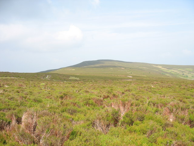
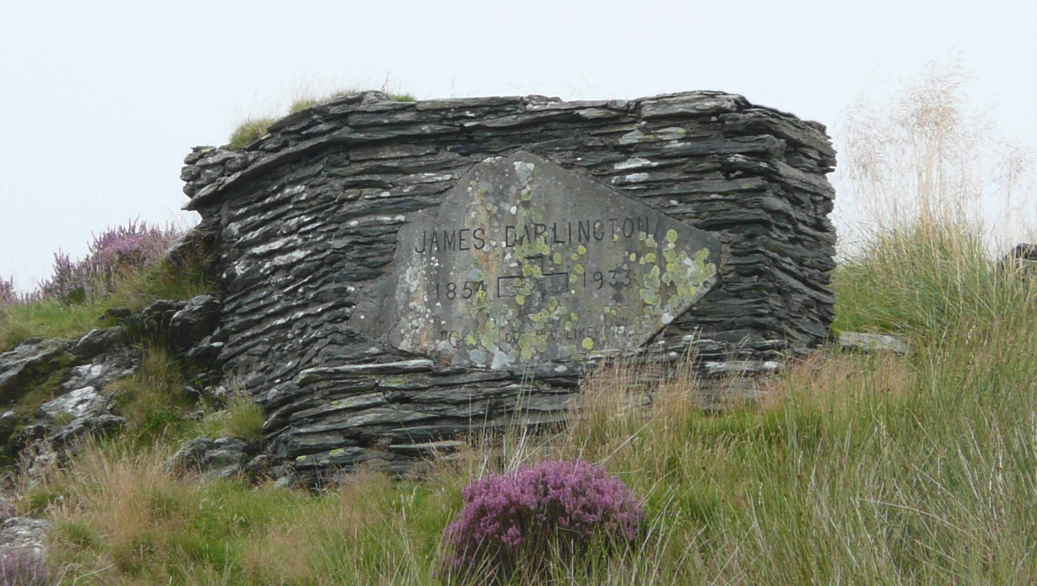
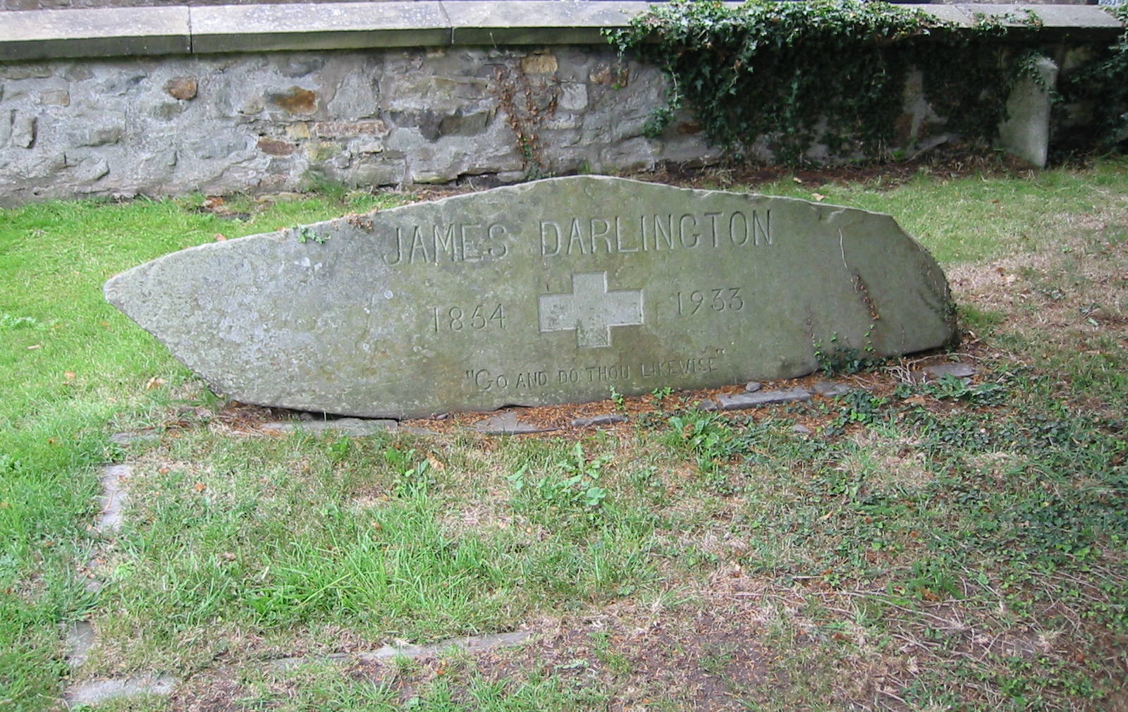
The river Ceiriog (“Afon Ceiriog” in Welsh) rises in the Dolydd Ceiriog, a gently sloping area of the Nantyr moors; the word “dolydd” means “meadow”. This stretch of land is bordered by mountains of the Berwyn range: Cerrig-Duon to the east, Cerrig Coediog to the west, and Moel Fferna to the north. The Ceiriog has its source on the south-eastern flank of Moel Fferna, about 1,800 ft (550 m) above sea level. In its upper reaches it is known as the Ceiriog Ddu (“Black Ceiriog”), perhaps because the water has been tinted by passing through peat. The easiest route to the source is via the Nantyr Road from Glyn Ceiriog. After 4.1 miles (6.4 km), at the entrance to the Plas Nantyr estate, this road ceases to be public for motor vehicles but walkers can continue westward, with the brook Nant Blaen-y-Cwm in the valley on their left. After 1.8 more miles (3.0 km), the footpath ends at a stone memorial to James Darlington, a local industrialist, and the rest of the walk to the source (1.6 miles, 2.5 km) is on a rough track over moorland. A stream flowing by the memorial joins the river just above the first waterfall. ![]() ©
©
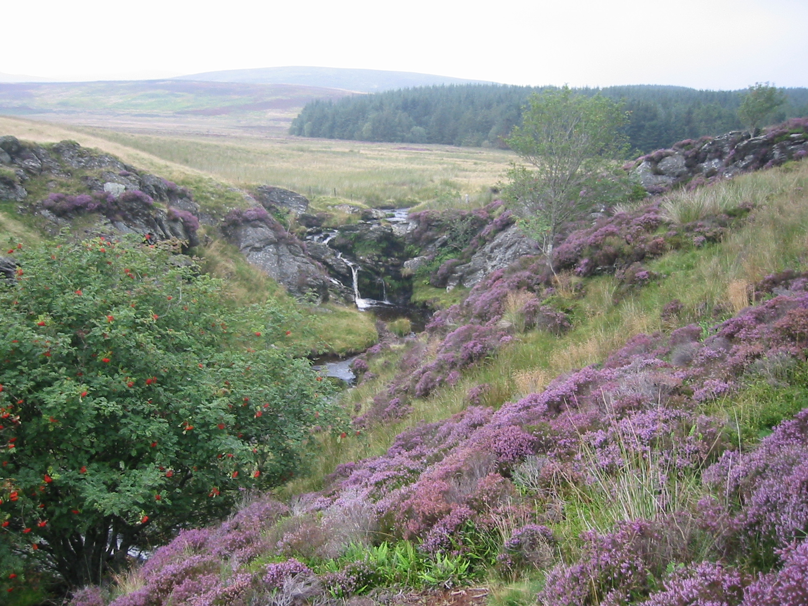
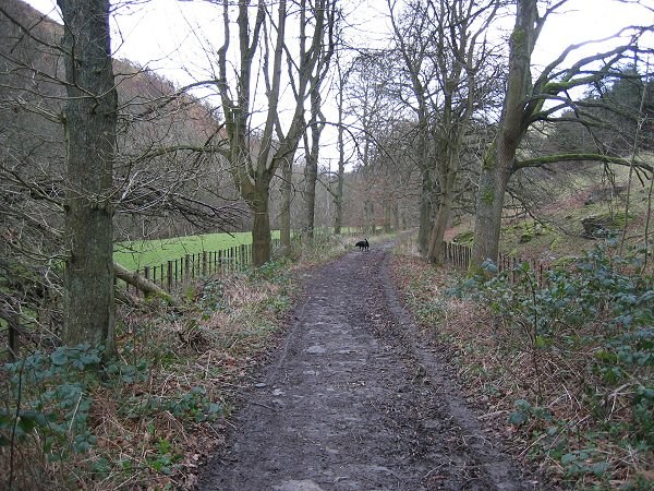
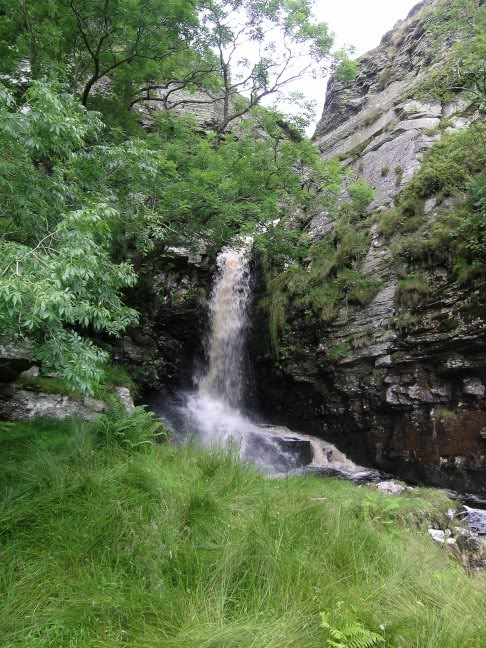 One of the many Ceiriog Falls
Waterfalls (1.8 mi, 3.0 km)
Leaving the Dolydd at its southern edge, the river turns southward, then enters a narrow valley and drops 300 ft (80 m) over the next ¾ of a mile (1.2 km) in a series of waterfalls called the Ceiriog Falls. How many they are, between eight and ten, depends on how one draws the line between a fall and a cascade. A narrow footpath on the eastern side of the valley offers the best views of the falls and the easiest ways to approach them. A less strenuous path, starting from Swch-Cae-Rhiw, goes up the valley on its western rim. ![]() ©
©
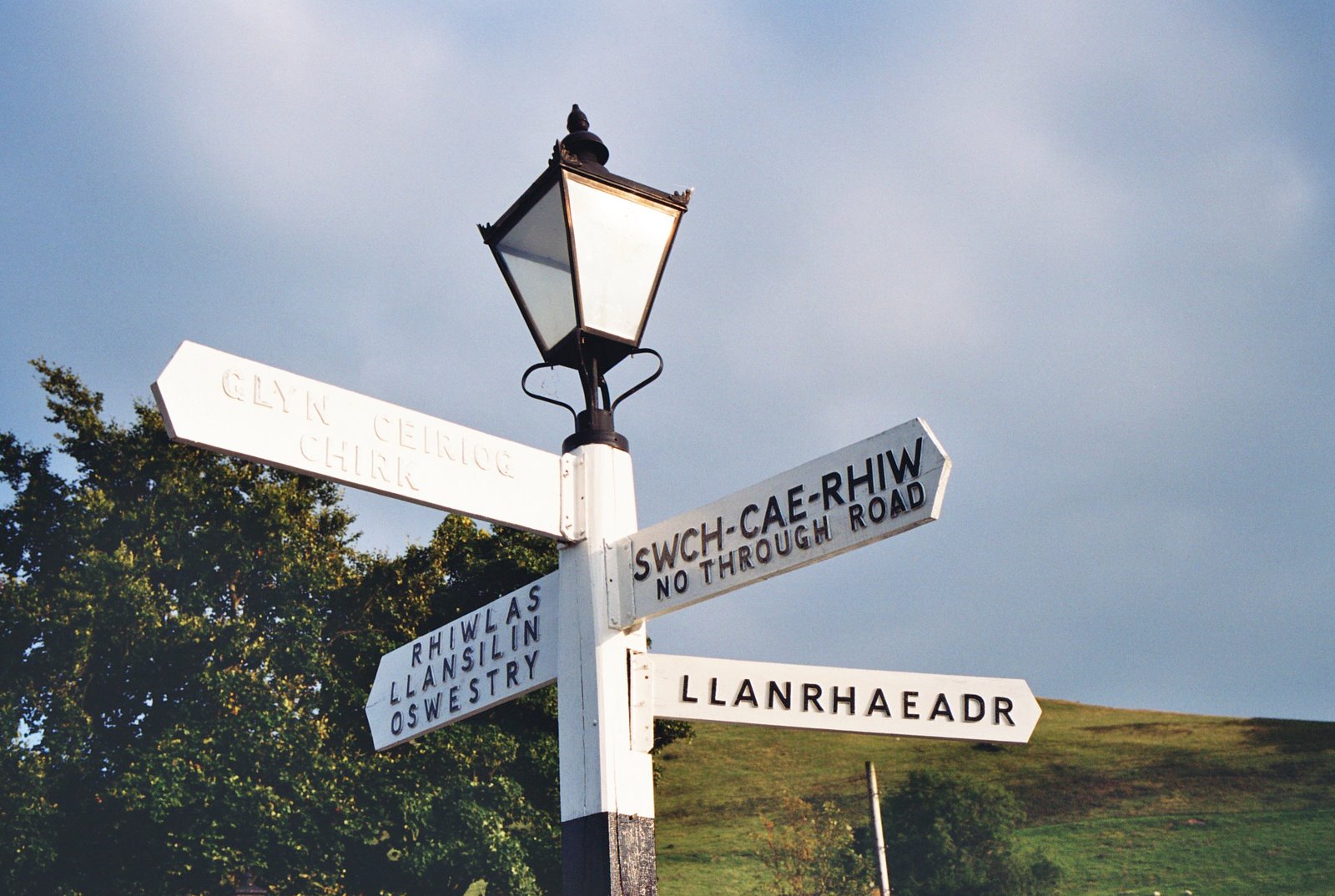
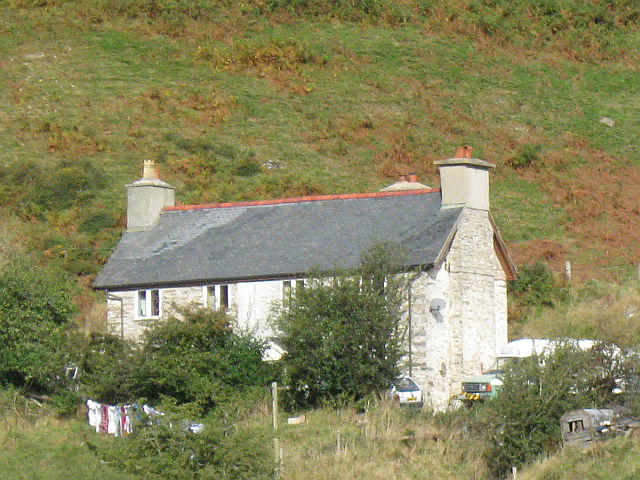 Swch farmhouse at the head of the Valley
Swch-Cae-Rhiw (2.9 mi, 4.7 km)
The farm of Swch-Cae-Rhiw is the farthest dwelling up the Ceiriog Valley, and here the surfaced road ends. A rough lane continues north-west to Llandrillo, initially following the brook Nant Rhyd Wilym which runs into the Ceiriog just below the farm. In the opposite direction, about 270 yards (250 m) along the lane to Pentre on the right bank of the river, a footbridge offers access to the eastern path up the valley. The present bridge dates from 2006; it replaced the original one built in the 1930s. From the falls downstream, there are trout in the river. Graig Fawr is the mountain north-east of the river on this stretch. ![]() ©
©
 Pentre chapel beneath Graig Fawr
Pentre Bach (3.5 mi, 5.7 km)
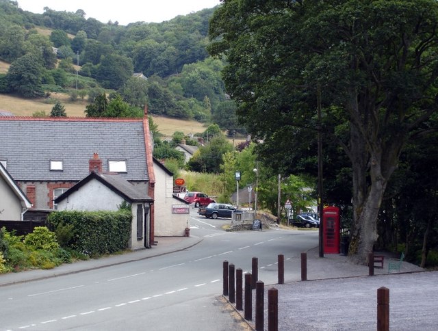
This place is a community made of several farms and cottages. The name “Pentre Bach” means “Small Village”; on maps it is often cut down to “Pentre”. Unsurprisingly, this name is shared with various other hamlets in Wales. For many years, from the previous century into the first decade of the present, Pentre possessed the chapel farthest up the Valley, and at the roadside nearby was the farthest telephone booth, an old-style red one. Now the chapel is disused, and the booth is in a sad state of disrepair. Here the Ceiriog has a tributary, Nant Cwm Llawenog, and there are two others further down the lane, Nant Cwm-y-Geifr quite close to Pentre and Nant Sarffle closer to Llanarmon. ![]() ©
©
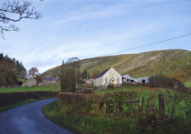
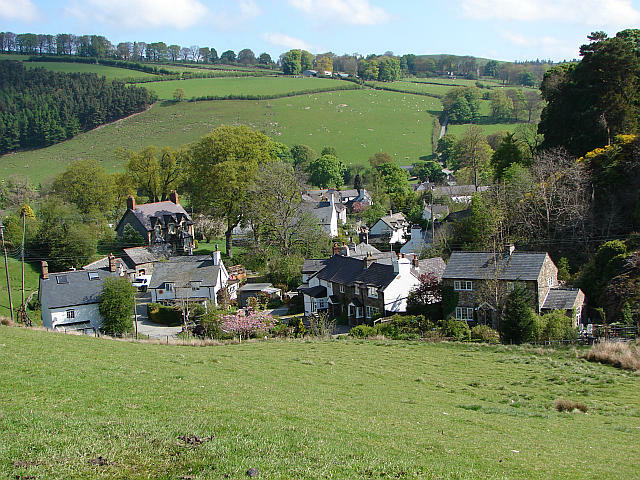 View of Llanarmon from the south
Llanarmon (5.4 mi, 8.7 km)
The full name of this village, Llanarmon Dyffryn Ceiriog, means “Garmon’s Church in the Ceiriog Valley”. “Garmon” was Saint Germain, the Bishop of Auxerre, in Burgundy, who visited Llanarmon on a mission to evangelize the Welsh in the 5th century AD. At the crossroads in the centre of the village, the road from Swch-Cai-Rhiw meets the one from Llanrhaeadr-yn-Mochnant. The former then continues toward Rhiwlas, Llansilin, and Oswestry, while the latter, now the B4500, continues toward Glyn Ceiriog and Chirk. The brook Nant y Glog flows through the village, then into the Ceiriog just below the bridge Pont Fawr which takes the B4500 across the river. ![]() ©
©
 Centre of Tregeiriog village
Tregeiriog (6.9 mi, 11.2 km)
On the B4500 road down the valley, the first village after Llanarmon is Tregeiriog. It too is centred on a crossroads. On the left, a road goes uphill along the Saxon Way (“Ffordd Saeson”), a very old track, while on the right it goes downhill and crosses the Ceiriog by the bridge Pont y Felin on its way to Rhiwlas. Further along the B4500 there is a large farm on the right, and a little way beyond it a minor road leads down to the bridge Pont Ricket, which replaced an ancient ford. The flagstones of the ford can still be seen from the parapet, especially on the downstream side; here the brook Nant Swrn flows into the river on its left bank. Beyond the bridge, this road goes past Hendre farm and on to the quarry. ![]() ©
©
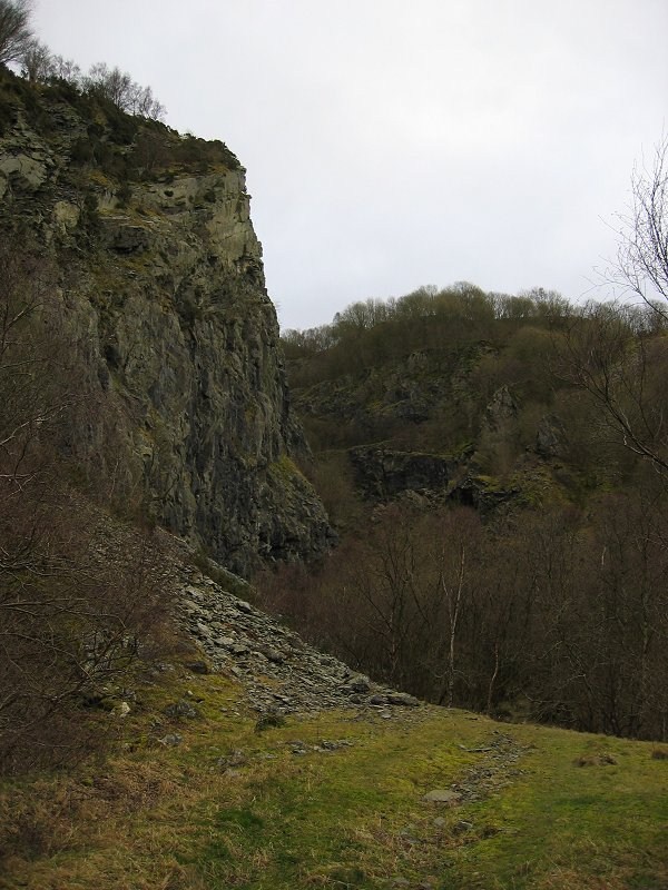 Rock face at Hendre Quarry
Hendre (7.9 mi, 12.6 km)
The Hendre, an open quarry for dolerite, was the largest of the many quarries that once operated in the Ceiriog Valley. Dolerite is a rock similar to granite. It was crushed into chippings used for making roads. The Glyn Valley Tramway, a narrow-gauge railway which ended at the quarry, took the chippings down to the Great Western Railway station at Chirk. After the tramway went out of business in 1935, they were carried by steam-driven lorries. The quarry was abandoned in 1950; the buildings that housed its offices and crushing plant are overgrown now and falling into ruin. The public can visit the quarry and the land around it, though these are private property. The owners conserve them as a sanctuary for wild life, and visitors are asked to respect their wishes. Below Hendre, the brook Nant Llechwedd-Glyn flows into the river from its right bank, close to the bridge Pont y Meibion. ![]() ©
©
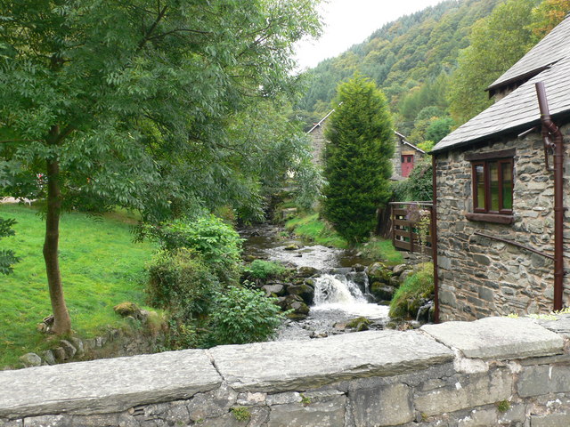 River Teirw at Pandy
Pandy (9.2 mi, 14.8 km)
Next along the B4500 is the hamlet of Pandy. Its name means “fulling mill”. Fulling is a process for cleansing woollen cloth, making it thicker, and turning it into felt. The mill, which was built in the 14th century, stands close to the road and is well preserved; it is now a glass-artist’s studio. Here the river Ceiriog is joined by its main tributary, the Teirw, which also rises on the Nantyr moors. Three-quarters of a mile (1.2 km) away, along on the road to Glynceiriog, a footpath leads down to the former track of the Glyn Valley Tramway. From this point up to the border of the Hendre Quarry, the track belongs to the National Trust and is open to walkers and pony trekkers; midway, at Pandy, it crosses the river on a bridge. ![]() ©
©
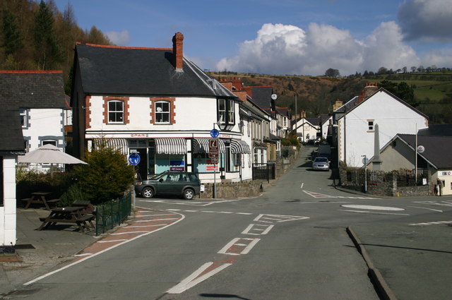
 High Street, Glyn Ceiriog
Glyn Ceiriog (10.6 mi, 17.0 km)
After Chirk, Glyn Ceiriog is the largest community in the Valley; about 1000 persons live there. Before World War II its principal resources were quarrying and mining. The main product was slate, though chinastone and silica were produced as well, while the largest of the several quarries, the Hendre, was a source of dolerite. The Glyn Valley Tramway, which had its engine shed on the edge of the village, carried these products to Chirk. After the war the demand for them declined, and the mines and quarries closed one after another. Though tourism has since become a resource (and plans are afoot for restoring at least part of the tramway), most of the villagers of working age now seek their employment elsewhere. The Ceiriog Memorial Institute in the High Street houses a collection of historical artifacts. At the lower end of this street, several roads meet at a roundabout: the B4500 arrives from Llanarmon, then goes on toward Chirk; the Quarry Road leads up to what was once the Chwarel Wynne slate mine; and the B4579 road heads south-east toward Selattyn, over the bridge Pont Hafodgynfor at the southern edge of the village. Here the Ceiriog turns east, and is joined first by Nant Lafar flowing south-east past the site of the former Cambrian slate quarry, then by Nant y Weniar flowing in from the north. At the eastern edge of the village, the B4500 goes over Pont Bell onto the right bank of the river. ![]() ©
©
 View from the bridge at Dolywern
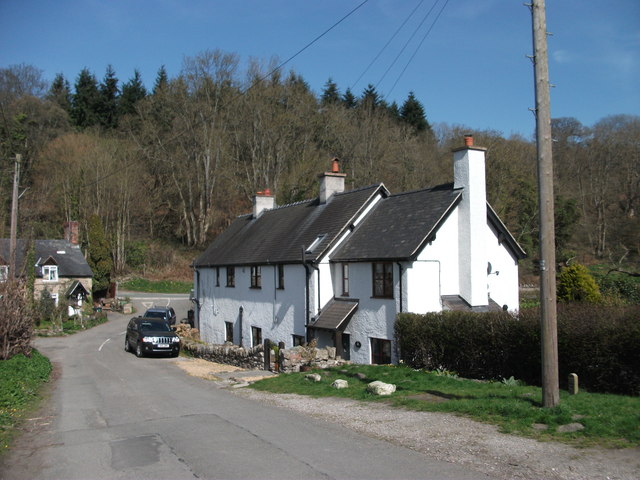
Dolywern (11.8 mi, 19.0 km)
At the village of Dolywern, the B4500 goes back across another bridge to the left bank, where it remains for the rest of the way to Chirk. The track of the Glyn Valley Tramway goes across a neighbouring bridge made of iron, to the left bank where it also remains. At Dolywern a former hotel has been converted into a Cheshire Home, one of the many such institutions created and run by the Leonard Cheshire Foundation as homes for disabled persons. Leonard Cheshire, VC, was a British bomber pilot in World War II. In the closing days of the war, as a passive observer, he witnessed the destruction of Nagasaki by an atomic bomb, and from then on he gave his life to caring for the disabled. In a bend of the river below the village, a weir used to divert some water to a corn mill on the right bank, at Pontfadog, where the brook Nant Gwryd also fed the mill race; in 1941 this weir was breached by a flood, so it had to be razed. ![]() ©
©
 Pontfadog village viewed from the car park
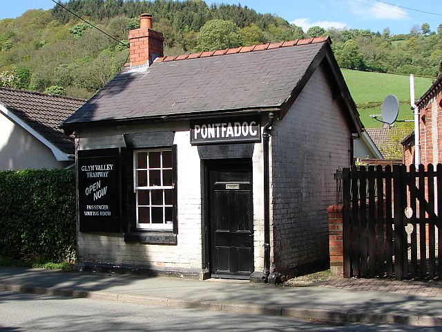
Pontfadog (12.9 mi, 20.7 km)
The name of this village means “Madoc’s Bridge”. Madoc (a.k.a. Madog) was a 12th-century prince, perhaps legendary; he is said to have been one of the many sons of king Owain Gwynedd. This narrow stone bridge across the river carries a lane to Bronygarth. In fact there are two bridges at Pontfadog: the other is on a side road that links the B4500 to the site of the corn mill Felin Lyn. The Glyn Valley Tramway (GVT) had a station here as well, and its waiting room has been preserved as museum. About a fifth of a mile (0.34 km) north of the village there once stood the largest and most ancient oak tree in Wales, until it was destroyed by a storm in April 2013; it was then at least 1200 years old. ![]() ©
©
 Cottages at Castle Mill
Castle Mill (14.4 mi, 23.1 km)
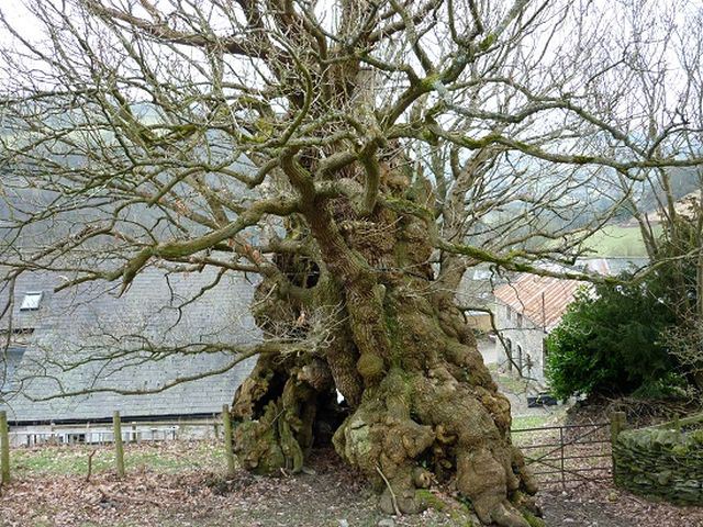
This hamlet is named after a mill that once belonged to Chirk Castle; it still exists as a cottage. Here a lane goes across the Ceiriog on a bridge, then joins up with the one from Pontfadog to Bronygarth. Offa’s Dyke, an 8th-century earthwork, traverses the Valley near Castle Mill. Offa was the king of Mercia from 757 to 796. His kingdom comprised much of what are now the English Midlands, and his dyke was designed to keep the Welsh out. The boundary between England (Shropshire) and Wales (Denbighshire) follows the dyke as it approaches Castle Mill from the south, then follows the right bank of the Ceiriog until this river joins the Dee. At Castle Mill the Valley is relatively narrow, and it was hereabouts that in the Battle of Crogen (1165) a coalition of Welsh princes, headed by Owain Gwynedd, ambushed and defeated the invading army of king Henry II. On the parapet of the bridge over the Ceiriog, a plaque commemorates the battle. On the opposite side of the main road, a path leads to several panels with additional information about it, and not far beyond them along the same path is a tree which, after the battle, was named “The Great Oak of the Gate of the Dead”; it was much damaged by bad weather in 2010. About a mile down the river from Castle Mill, another bridge, named Pont Faen, carries a road to Weston Rhyn. The Chirk Trout Farm is off the B4500 half-way between these two bridges. ![]() ©
©
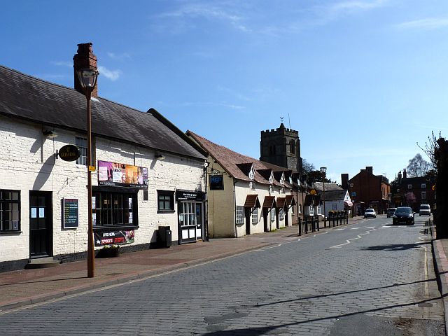 Church Street, Chirk
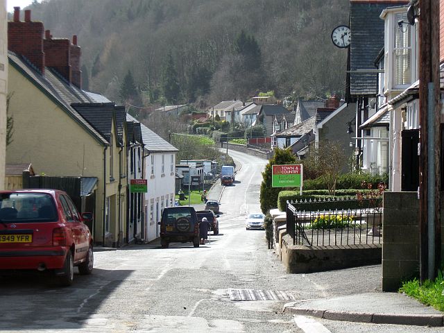
Chirk (13.9 mi, 27.3 km)
Chirk is a small town, with a population of over 4,000. Coal mining was its principal industry until late in the 20th century; a factory making wood-based panels and a chocolate factory are now the main sources of local employment. The town has a railway station, which used also to be the terminus of the Glyn Valley Tramway. Alongside the railway line is a branch of the Shropshire Union Canal; both traverse the Valley, the railway on a viaduct, and the canal on an aqueduct built by Thomas Telford in 1801. About a mile west of the town there is a medieval castle, well preserved, and cared for now by the National Trust. The parish church of St. Mary’s, in the town centre, dates from the 11th century. James Darlington is buried close by it, beneath an unusual tombstone. According to a local legend, it is a rock that he used to sit on while fishing in the river Dee. It bears the same inscription as the one on his memorial near to the source of the Ceiriog; another memorial to him stands at the entrance to the church. The Valley ends below Chirk, and at 20.0 miles (32.0 km) from its source the Ceiriog joins the Dee. ![]() ©
©
Photo credits
You will find many walks in the Ceiriog Valley on the Chirk and Ceiriog Valley website
Entry Forms
Contact us


Follow us on Facebook

Donate to us